When Hakai Institute science technician Emily Haughton heads up to Castlecrag Mountain on central Vancouver Island, she and her two colleagues take more gear than the usual backcountry campers. For the snowpack measurement field season that begins in the last weeks of winter, among their most essential items are touring skis—and a helicopter.
June 5th, 2024 | Originally published at Hakai Institute
Getting to the Core
A crack team of researchers hikes, skis, and cores their way to critical water supply data in the mountains of Vancouver Island, British Columbia.
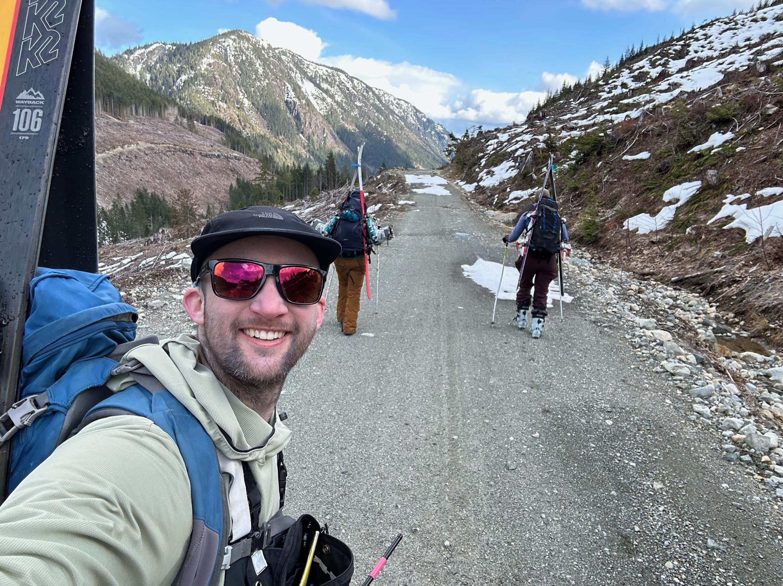
While the easiest way to access the Castlecrag Mountain base camp on Vancouver Island, British Columbia, is by helicopter, it can be reached later in the season by an eight-kilometer hike. Here, Hakai Institute science technicians Rob White, left, and Emily Haughton, right, hike in with Chloe Swabey of Vancouver Island University’s Coastal Hydrology Research Lab (CHRL). Photo by Rob White
“Getting in any other way with the amount of gear we have would be next to impossible,” says Haughton, noting that their base camp kit includes -20 °C sleeping bags, several meters of metal coring pipe, and a safari-type wall tent with a miniature wood stove. The wall tent functions as their cooking and living area; they have separate tents for sleeping.
Haughton is accompanied by Hakai Institute science technician Rob White and a rotating member from Vancouver Island University’s (VIU) Coastal Hydrology Research Lab. The chopper flight to the ridge study site at 1,348 meters is about as much of a free ride as they get. After setting up camp, the real work begins the next day: they strap on touring skis fitted with climbing skins to schlep 15-kilogram packs to designated snow coring locations anywhere from one to five kilometers away from camp—much of it uphill.
Once at a designated coring location—there are 10 near their Castlecrag base camp—they assemble the pipe and take five snow cores in a diamond configuration, as well as over 30 depth measurements. The steel or aluminum coring pipe is about four centimeters in diameter and can be extended to six meters. The pipe has serrated teeth at the tip, and by twisting a lateral handle called a driver they are able to drill through up to five meters of snow. In difficult conditions, drilling a single core can take 20 minutes.
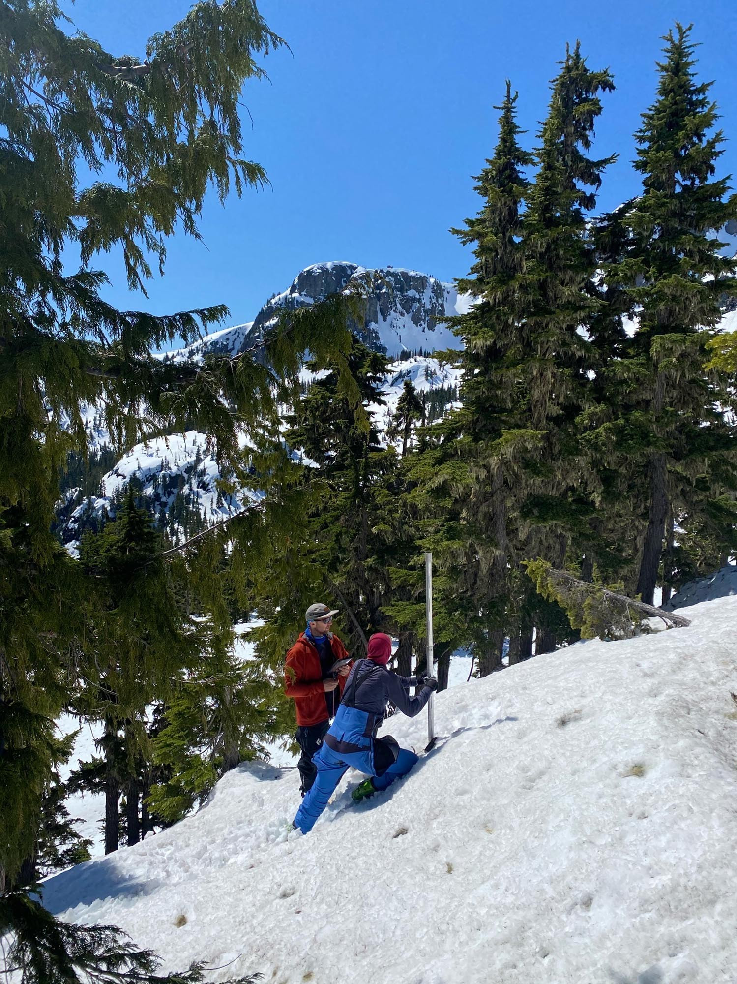
Haughton and White take a snow core sample near Castlecrag Mountain. Photo by Alex Cebulski
If this sounds like a workout for—pardon the pun—your core muscles, it is. It’s also a recipe for a sore back. Haughton and her colleagues may or may not have the coolest research gig around, but it is definitely one of the most exhausting. They take up to five trips a year between early March and July, with each trip lasting four to six days.
The purpose of all this toil is primarily practical rather than academic. Their sampling area is within the Cruickshank River watershed in the Comox Valley Regional District (CVRD) of Vancouver Island, and measuring snowpack is key to forecasting the local water supply.

White weighs a snow core on a ridge near Castlecrag Mountain. Photo by Alex Cebulski
It’s part of a greater collaborative effort—bringing together the British Columbia provincial government, VIU, the University of Northern British Columbia, the Hakai Institute, Metro Vancouver, the CVRD, and the Regional District of Nanaimo—to better understand how much snow contributes to freshwater resources for both ecosystem health and drinking water supply.
Their ski-and-backpack alpine sampling regime is done in conjunction with LiDAR surveys carried out by the Hakai Institute’s Airborne Coastal Observatory plane. LiDAR helps map the height of the snowpack; Haughton and her colleagues determine how dense it is. From this they are able to determine the snow-water equivalent, or SWE, a measure of the amount of water contained in snowpack.
“SWE is the money of the snow measurement world,” says Haughton, who did her fieldwork measuring snow cores in the Mackenzie River basin in the Northwest Territories. “It directly relates to how much water could be available during the summer drought season.”
Field observations are fed into a machine learning model that uses LiDAR data and observations from local weather stations to estimate density at a granular scale across the entire watershed, explains Bill Floyd, a research hydrologist with the BC Ministry of Forests. Floyd, a Hakai Institute affiliate, is also director of the Coastal Hydrology Research Lab (CHRL) at VIU.
“By multiplying the depth by density we obtain a SWE estimate every four square meters over an entire watershed,” says Floyd. “This allows us to estimate the total snow water volume in a watershed, something we have never been able to do with such high accuracy.”
The work selects for those who enjoy (and can handle) backcountry skiing—nine-tenths uphill hiking and one-tenth downhill sliding. And whether you’re trudging up or skiing down, says Haughton, “you have to be comfortable carrying large, heavy packs with random tubes sticking out everywhere and negotiating the terrain.”
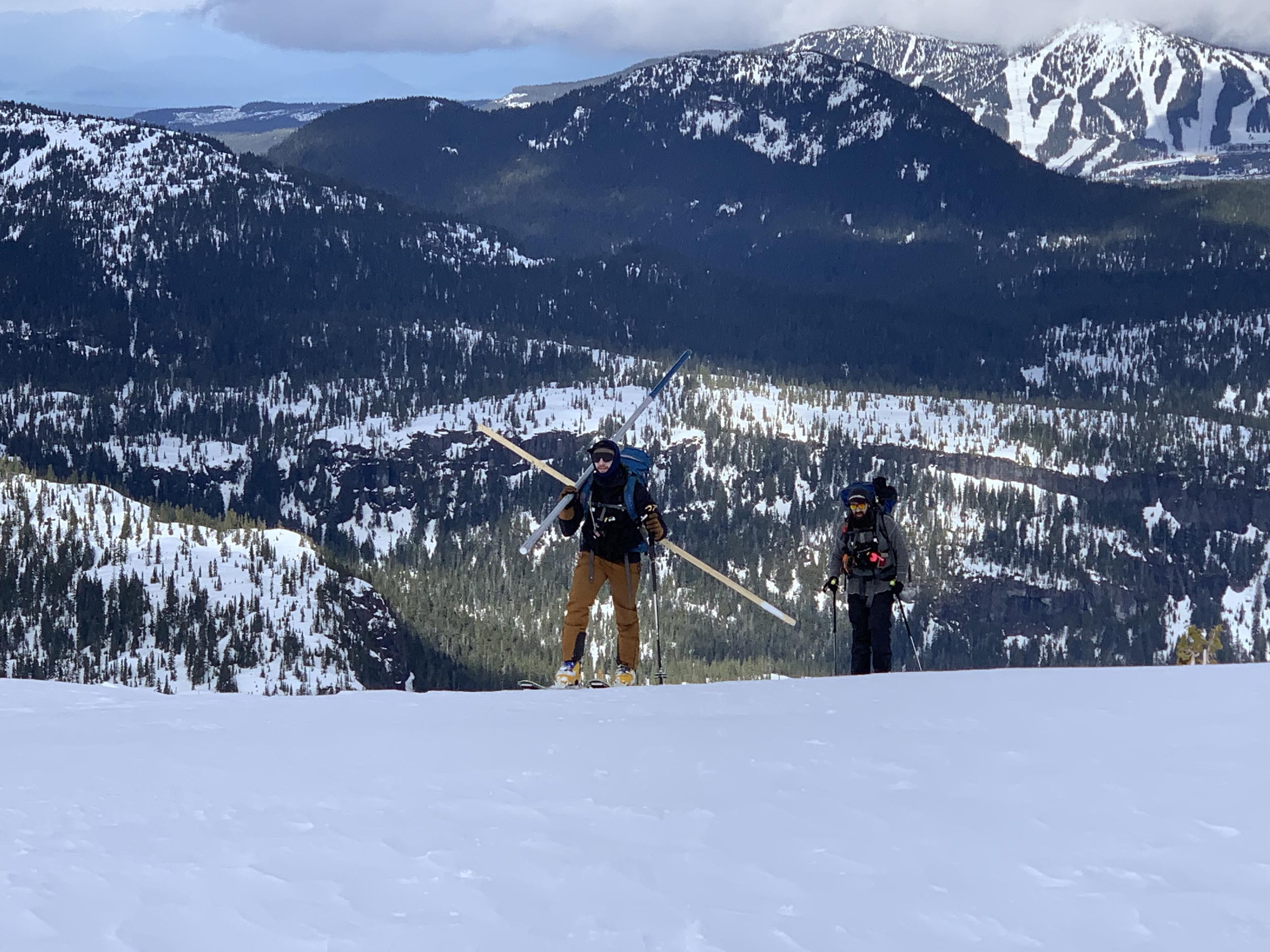
Laden with coring gear, White and Warren Olmstead of the CHRL trudge to a sampling plot. Photo by Emily Haughton
You also have to be fine with 12- to 16-hour days of alpine camping, with the implied fire-making and cooking to begin and end your days, and with waking up to make your coffee in -15 °C weather. It also means, at times, navigating the overlapping hazards of blizzards, high winds, and avalanches. While snow conditions can be treacherous, Haughton says she will take snow over rain any day.
“The rain saturates the snow, turning it into a wet and mushy mess. This makes touring incredibly hard—you sink past your knees with every step, your skins lose traction, and everything becomes soaked.”
Haughton and her colleagues have counterparts from the CHRL and Metro Vancouver across three other British Columbia watersheds (Tsitika, Englishman, and Seymour Rivers) who feed data into the snow observation program. Depending on the year, in some watersheds up to 40 percent of the water that people use—for drinking, showering, watering gardens, washing cars, and everything else—comes from snow. As of May 11, 2024, the CVRD team had estimated 55.38 million cubic meters of water stored as snow in the Cruickshank River watershed, enough to fill over 22,000 Olympic swimming pools.
“To me, what is really exciting and meaningful about this project is that we are producing a research product that is directly related to how much water will be available for community use,” says Haughton.
“For many of us it can be hard to connect the amount of snow in the mountains with our day-to-day lives. But taking measurements like these has direct implications for water resource management, especially during drought seasons when water preservation is critical.”
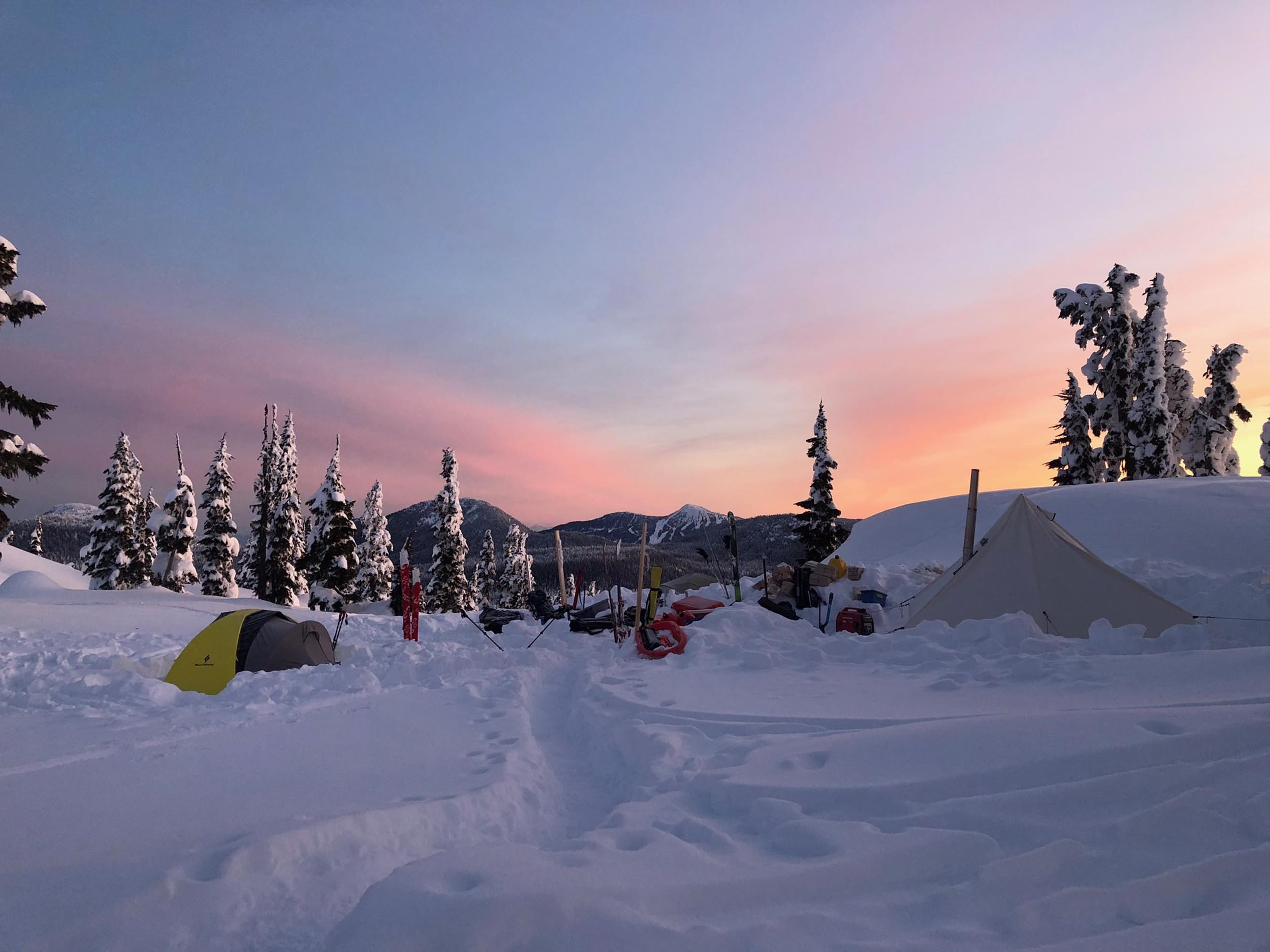
Snowpack research has its rewards, like this lingering sunset over camp. Photo by Alex Cebulski