August 7th, 2025
Short Takes
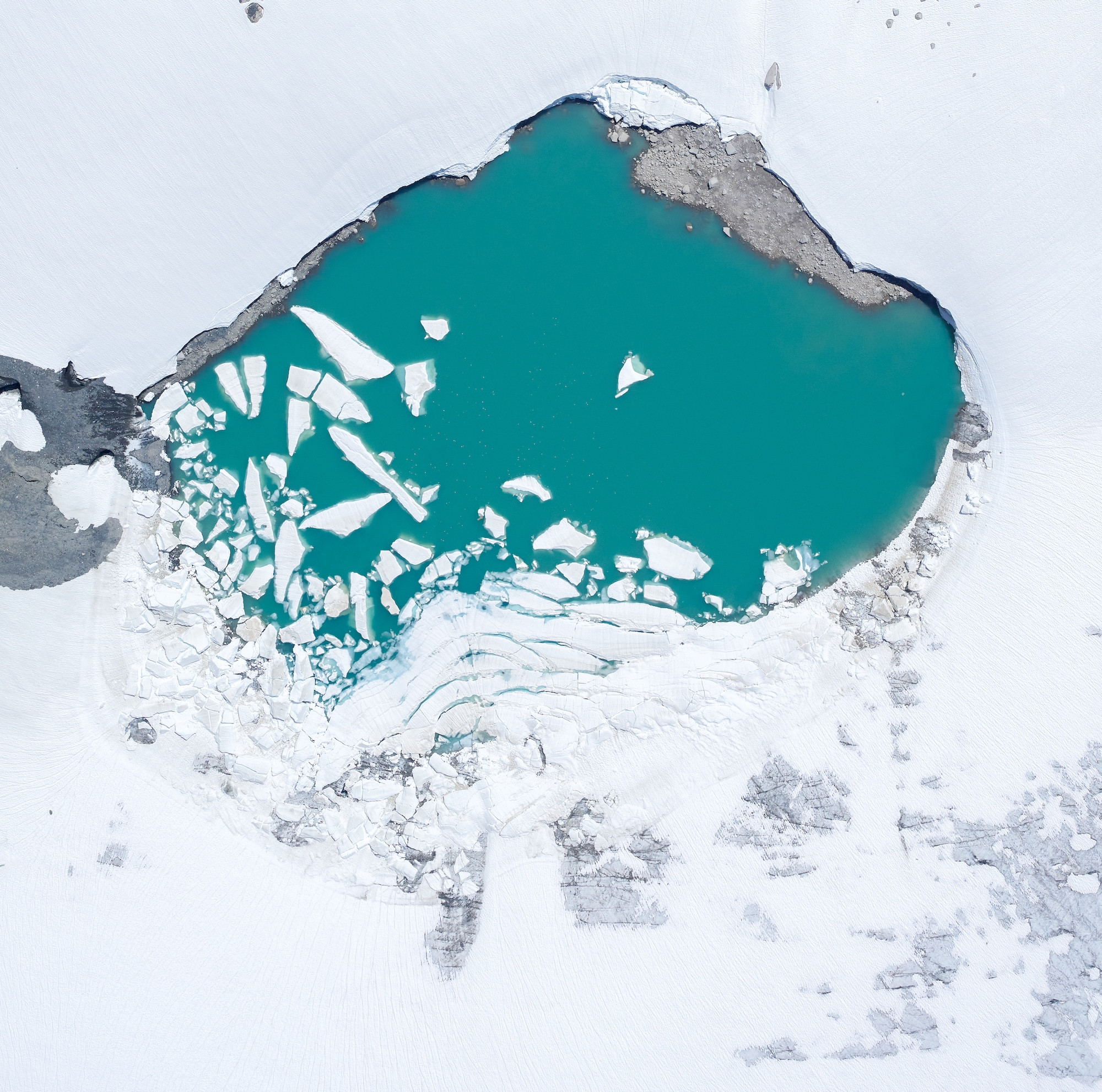
A meltwater pool on the surface of Place Glacier is another indicator of the continuing and rapid loss of ice there and throughout the global cryosphere.
In late July 2024, more than one million cubic meters of water suddenly drained from a lake on top of Place Glacier in western British Columbia, triggering downstream flooding. Researchers say the event was a hint of what’s to come.
Long monitored by the Geological Survey of Canada (GSC), Place Glacier is now at the center of a growing effort to understand our changing cryosphere—the parts of the earth where water is primarily frozen, including alpine glaciers, ice sheets, and areas of permafrost and snow. Scientists from the Hakai Institute, the University of Northern British Columbia, GSC, and the province are working to understand and anticipate these types of floods known as glacier outburst floods, which often occur during late spring and summer.
New instruments, including “smart” ablation stakes—autonomous devices that take high-precision readings of snow and ice melt —were installed in June to deliver real-time data on melt rates and water depth in glacier lakes. The team also installed new instruments to record water temperature and depth, both important measurements for predicting how much water can be released during these types of floods and when that might happen. The Hakai Institute’s Airborne Coastal Observatory is also supplying data on the glacier’s surface topography to help researchers assess how these types of lake basins grow and deepen through time.
Combining on-the-ground field work with satellite data from above, the Hakai Institute cryosphere team is improving predictions of when and how these outburst events occur.
A Secret History Beneath the Surface
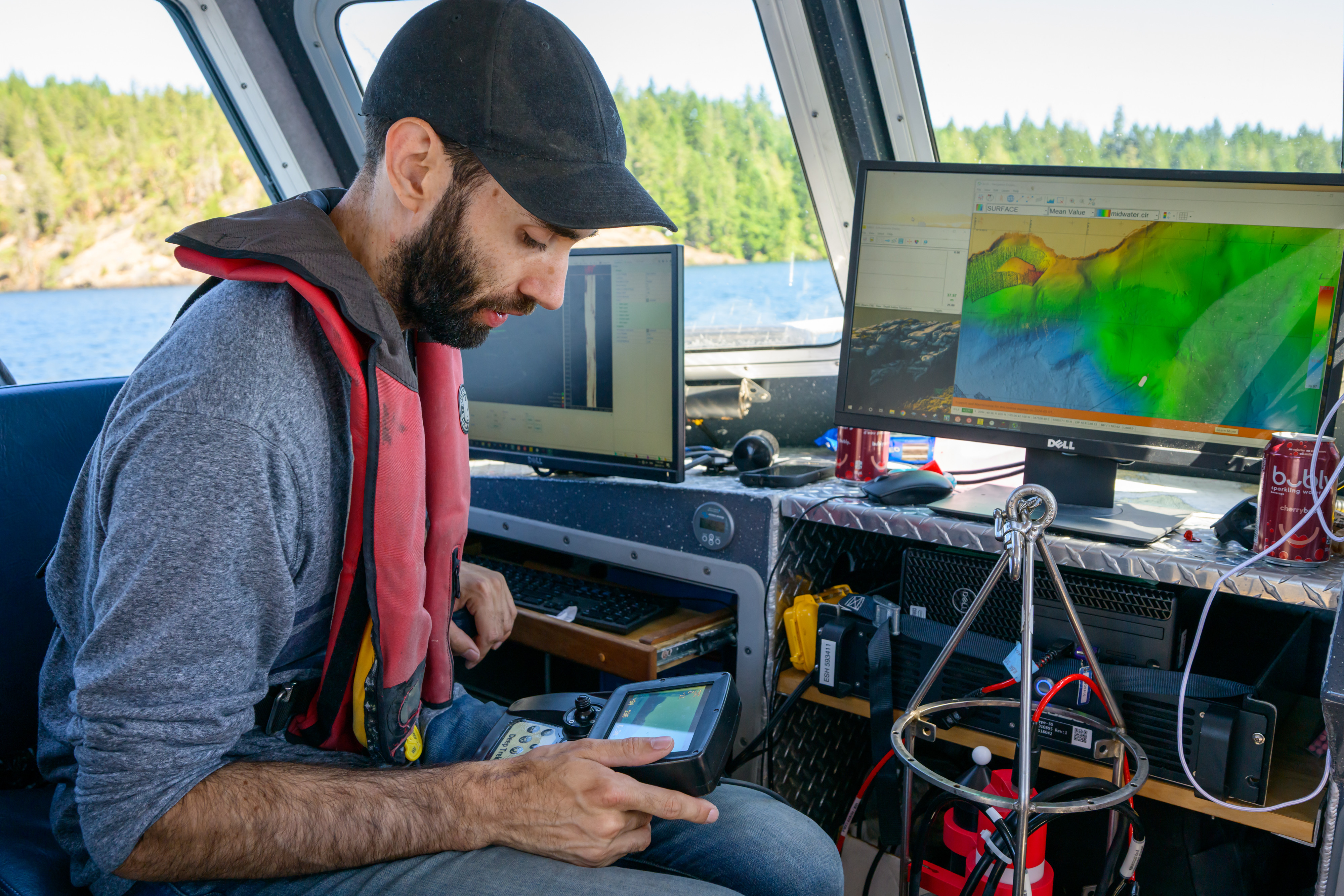
Hakai Institute hydrographer Nick Viner pilots a remotely operated underwater vehicle to get footage of the lakebed, looking for further clues of past landslides.
On a summer day, Comox Lake is busy with recreational boaters and zooming jetskis, and little suggests that the area has a history of violent landslide events. But beneath the surface, buried in the mud of the lake, lies a surprising geological record.
Thanks to high-resolution lakebed surveys, researchers are uncovering a hidden history of underwater landslides, preserved in layers of sediment.
Hakai Institute hydrographer Nick Viner operates multibeam sonar for the survey, and also pilots a remotely operated underwater vehicle that takes footage of the lake bottom. “Once you see a big tree and it’s got that root ball still intact but broken, that lets us know this tree was ripped out and put here by something like a landslide,” says Viner.
Led by the Geological Survey of Canada under its Natural Hazards and Climate Change Geoscience Program, the project combines underwater mapping with seismic profiling to trace the scars of past disasters on both Comox Lake and Horne Lake on Vancouver Island.
Employing multibeam sonar, the Hakai Institute’s bathymetric surveys provided the first step, revealing a surprising number of underwater landslide features. These collapsed slopes, which may have been triggered by earthquakes, offer possible evidence of both recent and prehistoric events.
Some evidence is well known—like the Magnitude 7.3 earthquake in 1946 that triggered a landslide and wave on Comox Lake. But researchers suspect that much older events are preserved in deep layers of the lakebed.
The next step for researchers is to use sub-bottom acoustic profilers to look beneath the surface for buried landslide deposits, which could offer further signs of past seismic activity. Together, these technologies are painting a fuller picture of Vancouver Island’s geological past, and offering clues for preparing for its seismic future.
Dungeness Detection: Where Are All the Megalopae From?
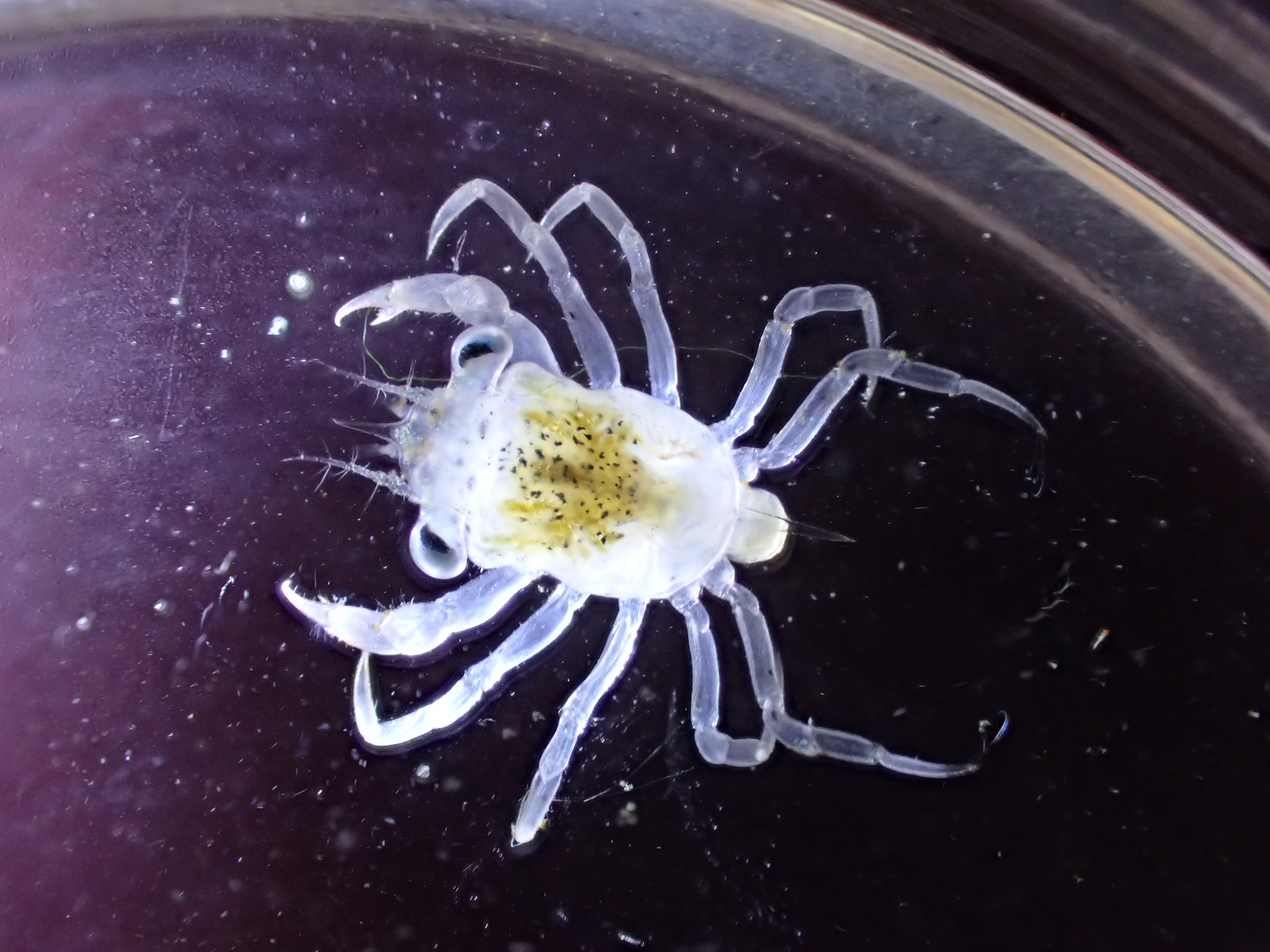
No bigger than a pinky fingernail, Dungeness crab megalopae are larvae in the final swimming stage, just before they settle down to feed on the ocean floor—where they can grow to a shell width of over 20 centimeters.
Tiny Dungeness crab larvae drifting along British Columbia’s coastline could hold clues to a bigger mystery surrounding their origins. The Sentinels of Change program, managed by Hakai Institute scientists along with local experts and community volunteers, uses light traps—plastic jugs equipped with LED lights—to attract and then count the tiny crabs, known as megalopae. Trap locations mainly span the Salish Sea from Seattle, Washington, to British Columbia’s Quadra Island, with some outliers farther south and north.
Despite the broad geography of sampling, scientists still don’t know whether the Dungeness megalopae turning up in their traps originate from distinct local crab populations or one superpopulation that spans the Salish Sea.
Are early-season larvae coming from different populations than those that show up later? And how far can these baby crabs travel? To answer these questions, researchers at the Hakai Institute will sequence the genomes of larvae collected from 10 locations across British Columbia—providing the first-ever genomic snapshot of Dungeness crab population structure in the province.
While similar work in Washington State concluded that all crabs came from one giant population, the results from British Columbia’s dynamic and diverse coastline might tell a different story. This work could have implications for how Fisheries and Oceans Canada and First Nations manage their crab fisheries, since conservation measures depend on understanding whether there’s one stock—or many—to protect.
Snow Counts
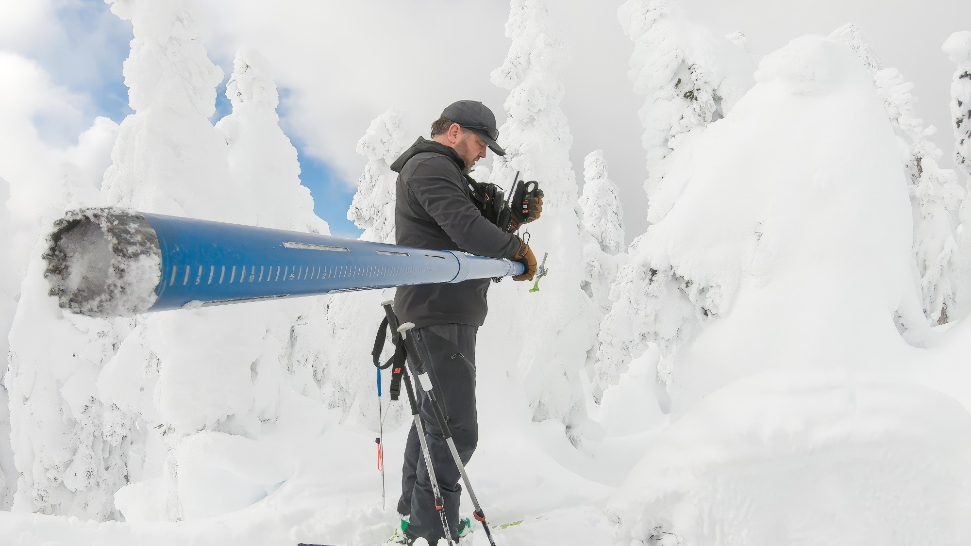
Bill Floyd, a research hydrologist with the BC Ministry of Forests and an adjunct professor at Vancouver Island University, measures snowpack with a snow corer near the summit of Vancouver Island’s Mount Arrowsmith in April 2021.
How much water is stored in snow? Bill Floyd, a research hydrologist with the BC Ministry of Forests and an adjunct professor at Vancouver Island University, is helping to answer that question with snow surveys across southern British Columbia. Working with the Hakai Institute’s Airborne Coastal Observatory, University of Northern British Columbia, and local partners, Floyd’s team at the Coastal Hydrology Research Lab translates raw measurements of snowpack into snow-water equivalent maps—a valuable addition to the watershed management toolbox.
The team has been collaborating with the Metro Vancouver, Nanaimo, and Comox Valley regional districts since 2020, expanding to additional watersheds as interest grows. Their approach combines on-the-ground data collection—for example, digging snow pits to measure depth and density—with aerial LiDAR surveys of the same areas. Together, these methods generate reliable estimates of how much water is stored in seasonal snowpack.
The data is especially important for water managers in this region where snowpack is highly variable due to warm winter temperatures that turn snow into rain. Peak snow volume can nearly double or halve from one year to the next, with watersheds becoming free of snow at entirely different times, depending on how warm the spring is. While Floyd notes that four or five years is too short to detect trends, the regional variability is striking.
As the climate shifts, turning snow data into clear, usable information about water supply is no longer a luxury—it’s a necessity.
New Condos Set Up in Owen Bay—For Invertebrates
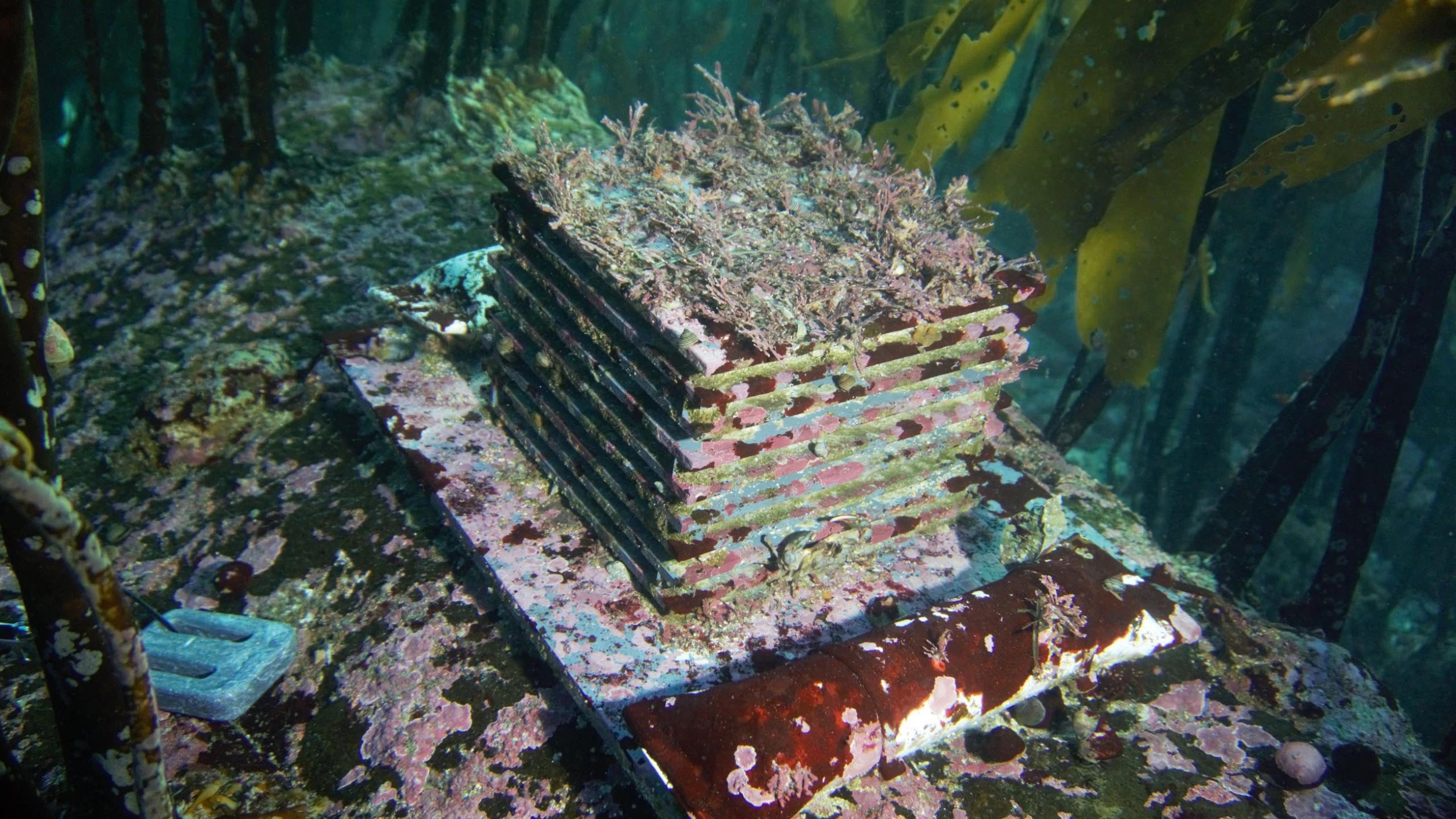
Autonomous Reef Monitoring Structures (ARMS) are a way to monitor the presence and development of invertebrates—such as coral, nudibranchs, barnacles, snails, and worms—using seafloor "condominiums" that are retrieved annually to see who moved in.
Autonomous Reef Monitoring Structures (ARMS) are stacks of PVC plates that mimic natural habitat. These artificial structures sit on the ocean floor and are designed to allow colonization by sessile organisms such as seaweeds and bryozoans, but also capture small mobile invertebrates such as crabs, snails, and limpets.
ARMS are used around the world for monitoring the biodiversity of seafloor and reef communities. They have more typically been deployed in tropical zones, but this project provides researchers in the Sentinels Alliance—a Hakai Institute initiative—a new way to study kelp forests and assess species composition in the temperate waters of the Salish Sea.
As part of a pilot study, 10 ARMS were placed in Owen Bay on Sonora Island, British Columbia. Five units were installed in kelp forests and five in adjacent urchin barrens, helping researchers to determine if this number of ARMS will be enough to capture the biodiversity of organisms when the project scales up. As the project expands, researchers will gain a more holistic understanding of kelp forest biodiversity in the region.
ELVIZ: Dancin' to the Geo-house Rock
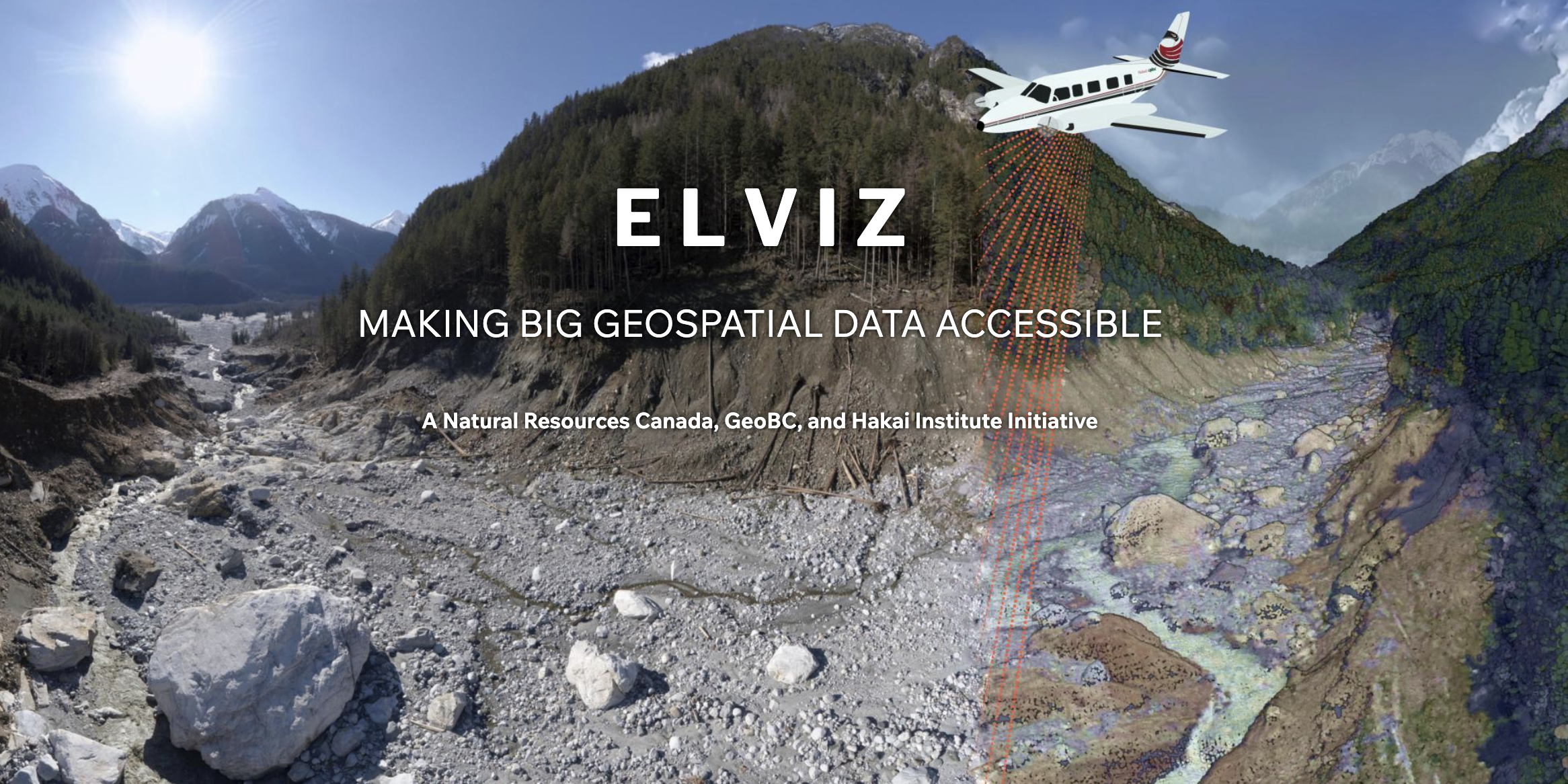
Featuring an array of high-precision data, including imagery, hillshade, slope, and elevation, ELVIZ goes beyond simply displaying the landscape—it unveils its transformations.
After a year of collaboration and hard work, the Hakai Institute’s geospatial team, in collaboration with Natural Resources Canada (NRCan) and GeoBC, is excited to introduce ELVIZ.ca. This new tool delivers complex geospatial information from LiDAR data and images from the Hakai Institute’s Airborne Coastal Observatory, helping users see change in Earth’s dynamic landscapes.
ELVIZ isn’t just a map—it’s a dynamic tool for exploring how landscapes change. High-res LiDAR data lets ELVIZ users track terrain shifts over time, compare past and present, and dive deep into the details—all from their browsers. ELVIZ is a prime example of the Hakai Institute’s data mobilization efforts in action.
Behind the Lens on an Island Bioblitz
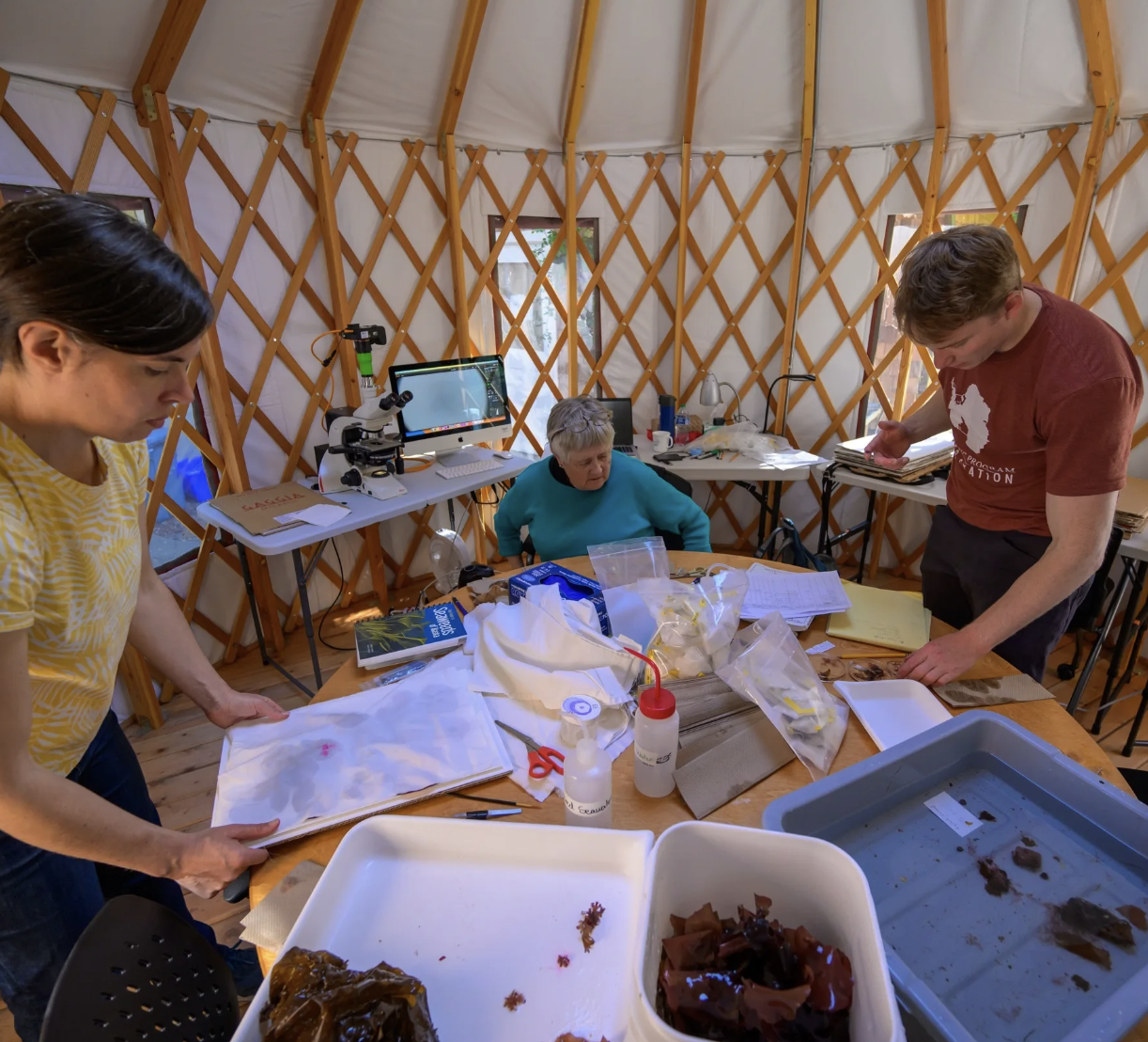
Margot Hessing-Lewis and Isaak Haberman work on either side of Sandra Lindstrom, an adjunct professor at the University of British Columbia, to press unique seaweeds for long-term preservation and to allow detailed examination of their morphology and structure.
A new photo essay by Hakai photographer Bennett Whitnell takes readers to a marathon, three-week biodiversity survey on Quadra Island, British Columbia. Scientists and budding naturalists sift through mosses on the forest floor, clamber over seaweed-covered rocks, and dive into underwater worlds, unearthing the island’s hidden marvels—from a glow-in-the-dark moss to a parasitic barnacle to a basket star straying far from its usual home in the deep sea. Bennett's visual journey captures the curiosity and camaraderie of a team united by the thrill of discovery, inviting readers to see the island’s life in a whole new light.