Kelp forests are iconic features of the British Columbia coastline—dynamic, seasonal ecosystems that provide essential habitat, influence ocean conditions, and support coastal food webs. Two canopy-forming species dominate these waters: giant kelp (Macrocystis pyrifera) and bull kelp (Nereocystis luetkeana). Both are highly sensitive to changing ocean environments, making them critical indicators of ecosystem change and resilience.
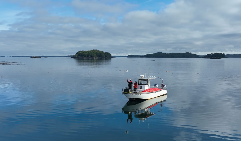
Climate change, marine heatwaves, and other stressors have driven the need for accurate monitoring of kelp forests to inform kelp conservation, management, and restoration. While traditional methods such as dive surveys offer detailed insight at a local scale, the advent of drones, satellites, and other remote-sensing technologies have opened a new frontier—allowing researchers to map entire coastlines quickly and efficiently.
Since 2015, the Hakai Institute has been at the forefront of kelp forest monitoring using drones, and of managing the resulting data—collecting drone imagery is easy, processing it efficiently is not. In response, the Hakai Institute developed Kelp-O-Matic, a machine-learning-based tool and data pipeline to automate the classification and analysis of drone imagery. This innovative approach has become foundational to kelp monitoring across the northeast Pacific.
Partners
The Hakai Institute’s drone-based kelp monitoring program has grown through collaboration with a diverse range of partners. Chief among them is the Marine Plan Partnership (MaPP)—a co-led initiative of 17 First Nations and the BC government that guides marine planning across Haida Gwaii, the North Coast, Central Coast, and North Vancouver Island. Indigenous-led stewardship across these regions, including Coastal Guardian teams, have collaborated in the development of drone protocols for kelp forest monitoring with the Hakai Institute. Many collaborating MaPP Partners, including the Council of the Haida Nation, Heiltsuk Integrated Resource Management Department, and the Nanwakolas Council, use the Kelp-O-Matic to process their data.
The Hakai Institute also partners with Parks Canada in two key regions of the coast: Pacific Rim National Park Reserve (PRNPR) and Gwaii Haanas National Marine Conservation Area Reserve and Haida Heritage Site. Since 2016, we've mapped and monitored kelp as part of long-term ecological restoration, aligning with the Archipelago Management Board’s mandate to “protect and conserve habitats, species and food webs.” In 2017, PRNPR transitioned from dive-based surveys to drone mapping and adopted the kelp mapping methods developed by Hakai Institute. Hakai Institute and PRNPR scientists are actively working together to develop indicator reports cards to communicate the status of kelp forests within PRNPR.
Timeframe
Our kelp monitoring initiative began in 2015 when drone surveys were first deployed. The development of the Kelp-O-Matic approach was completed in 2021–2022. This program is embedded in the Hakai Institute’s’s long-term ecological monitoring plans, with full scoping and methodological refinement expected in 2026.
Context
This project builds upon more than a decade of experience from the Hakai Institute’s Marine Habitat Mapping and Geospatial teams, whose focus has been creating spatial inventories of coastal habitats and understanding their temporal dynamics. The new methods not only address a bottleneck in data processing but also pave the way for analytic tools that analyze kelp time series and validate satellite-derived observations.
Outcomes
This project introduced Kelp-O-Matic, an open-source, state-of-the-art tool widely adopted for drone-based kelp forest mapping. As a result, it has empowered First Nations, NGOs, and coastal partners to independently monitor local kelp forests and respond to environmental change.
The methods, tools, and protocols are now used in federal and provincial/state organizations (e.g. DFO, Parks Canada, NOAA, WADNR, BC Government), academic research groups (e.g. UVic, UCLA, SFU), coastal First Nations (e.g. Toquaht First Nation, Haida Nation, Heiltsuk First Nation, Nanwakolas Council), and NGOs (e.g. the Nature Conservancy of California, the Nature Conservancy of Australia, Redd Fish Restoration Society).
The Hakai Institute has also shared shared this work at international forums including the Coastal and Estuarine Research Federation, the International Temperate Reef Symposium, the International Kelp Mappers Community of Practice, Western Society of Naturalists, International Seaweed Symposium, and Coastal Zone Canada, and is working on a peer-reviewed publication detailing our approach and findings.


