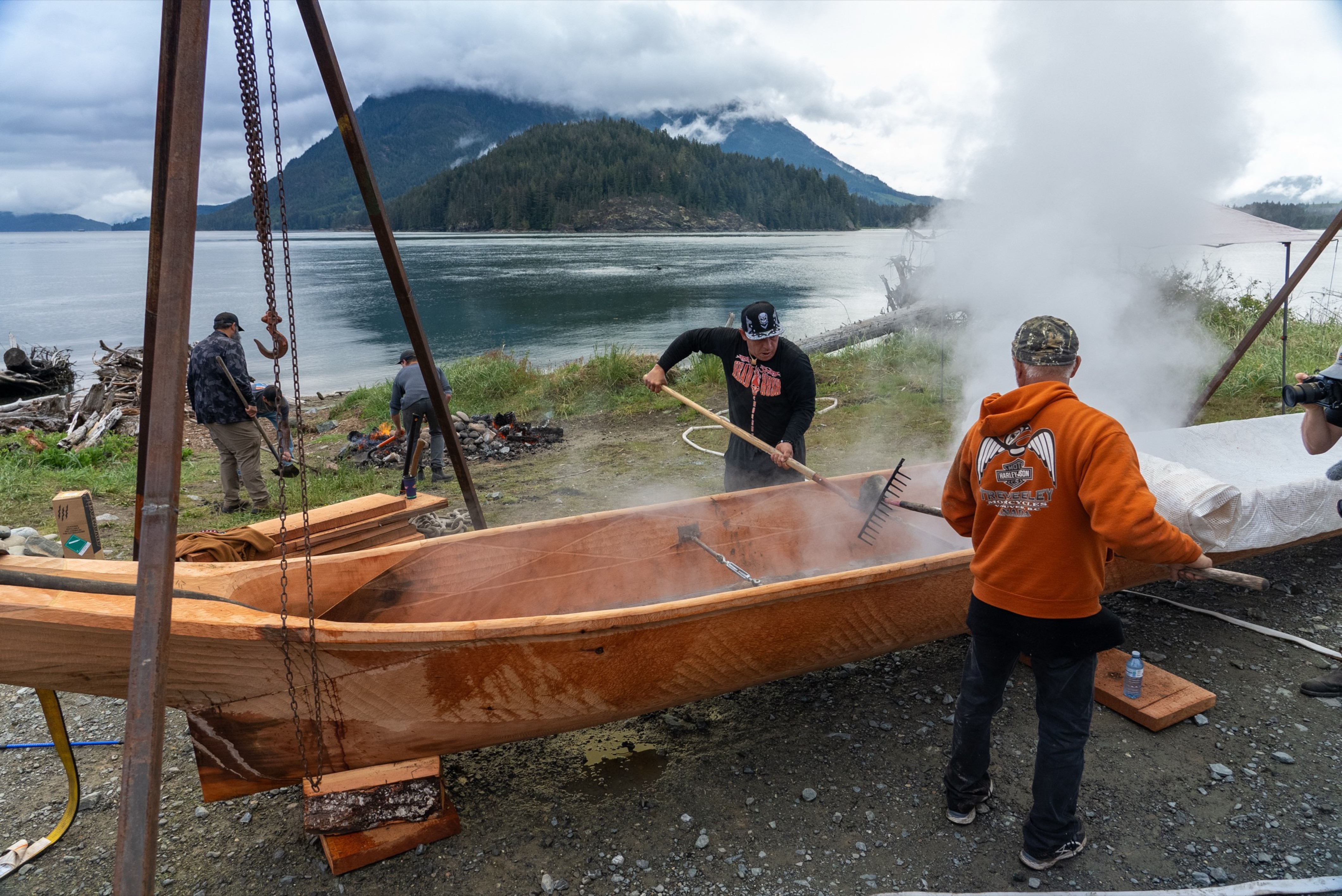
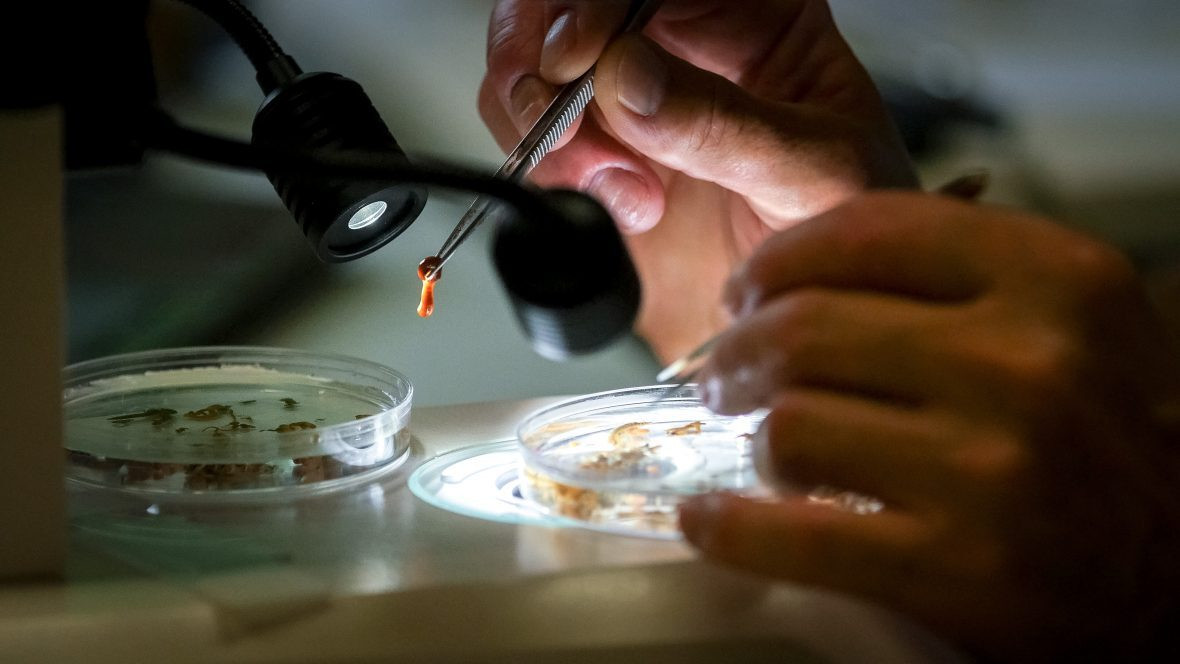
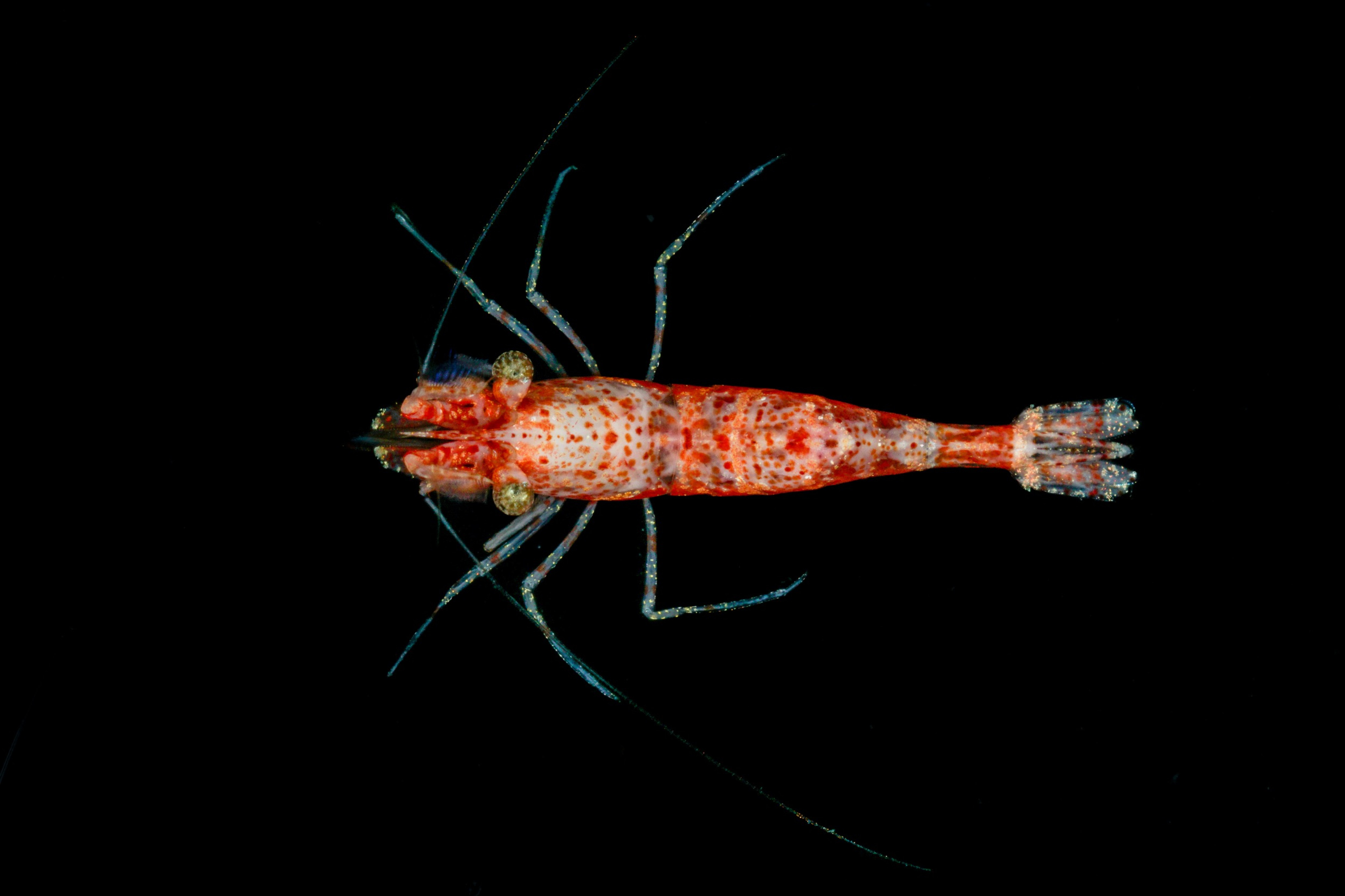
Ancient and contemporary shellfish cultivation practices bolster bivalve communities and diversity‐biomass relationships
Marine ecosystems provide humans with access to nutritious food. The discussion surrounding the cultivation of intertidal resources currently focuses on recent decades, disregarding a robust history of complex social‐ecological interactions and environmental stewardship. Here, we use the co‐occurrence of Indigenous clam gardens, shellfish aquaculture farms, and unmodified beaches along Canada's West Coast to test the hypothesis that two different resource management practices, one engineered over millennia and the other decades, bolster contemporary bivalve communities.
Cox, K. D., Davies, H. L., Millard- Martin, B., Black, M., Hessing- Lewis, M., Smith, N. F., Juanes, F., & Dudas, S. E. (2025). Ancient and contemporary shellfish cultivation practices bolster bivalve communities and diversity- biomass relationships. People and Nature, 7, 81–98. https://doi.org/10.1002/pan3.10724
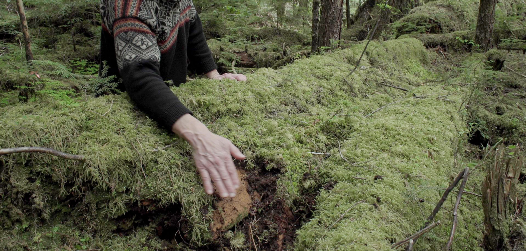
Genetic differentiation and precolonial Indigenous cultivation of hazelnut (Corylus cornuta) in western North America
Cultivation studies evaluating land-use histories and coevolutionary dynamics between humans and plants focus predominantly on domesticated species. Traditional anthropological divisions of “foragers” and “farmers” have shaped our understanding of ancient cultivation practices but have several limitations, including how people stewarded and managed nondomesticated species. To investigate the long-term effects of plant management in the Pacific Northwest, this study focuses on beaked hazelnut (Corylus cornuta) which has a long, precolonial history of management, transportation, and cultivation in British Columbia.
Armstrong, C. G., Clemente-Carvalho, R. B. G., Turner, N. J., Wickham, S., Trant, A., & Lemay, M. A. Genetic differentiation and precolonial Indigenous cultivation of hazelnut (Corylus cornuta, Betulaceae) in western North America. (2024). Proceedings of the National Academy of Sciences, 121(48). https://pnas.org/doi/10.1073/pnas.2402304121
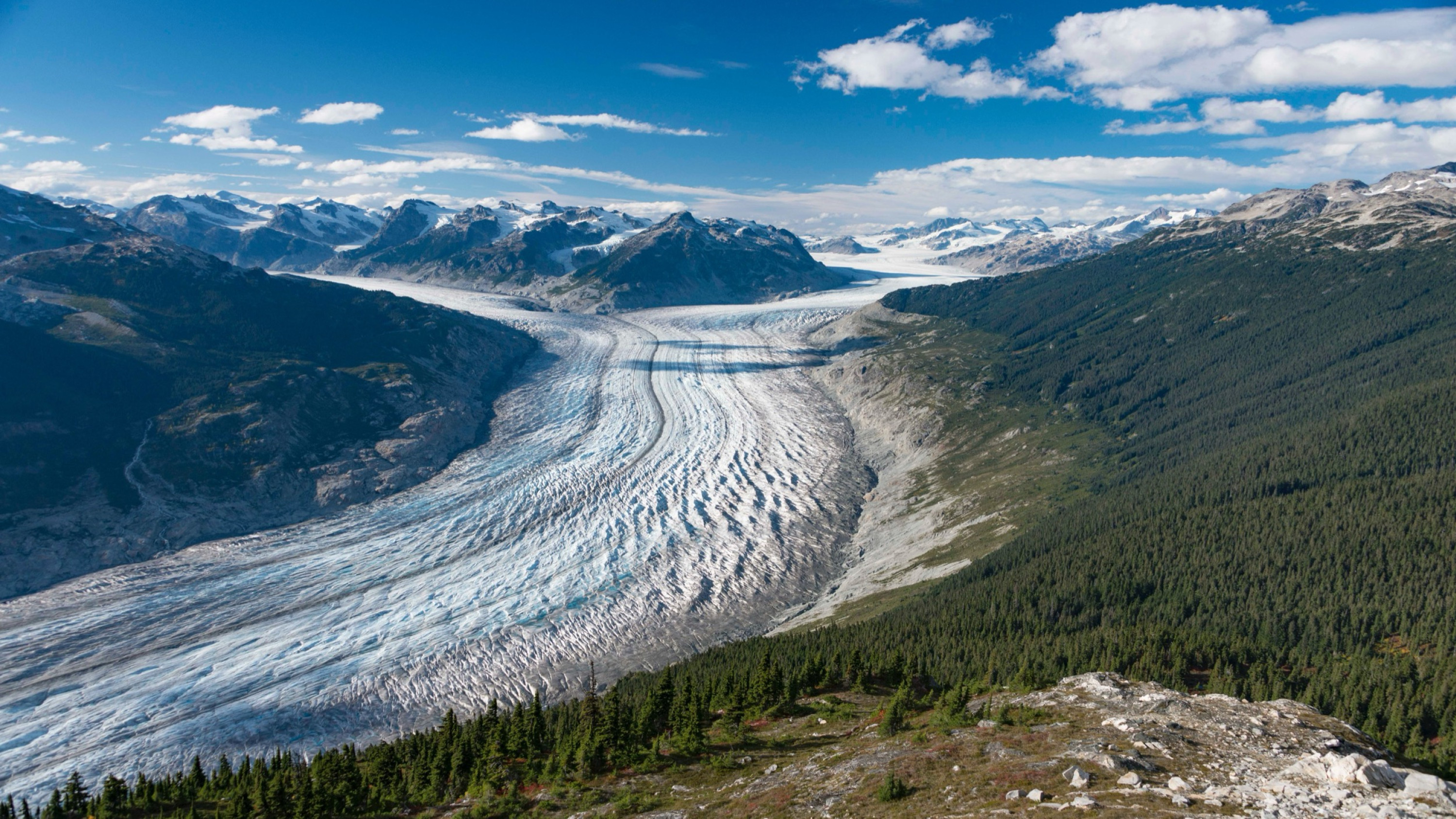
Airborne lidar intensity correction for mapping snow cover extent and effective grain size in mountainous terrain
Differentially mapping snow depth in mountain watersheds from airborne laser altimetry is a valuable hydrologic technique that has seen an expanded use in recent years. Additionally, lidar systems also record the strength of the returned light pulse (i.e. intensity), which can be used to characterize snow surface properties. For near-infrared lidar systems, return intensity is relatively high over snow and inversely related to the effective grain size, a primary control on snow albedo.
Ackroyd, C., Donahue, C. P., Menounos, B., & Skiles, S. M. (2024). Airborne lidar intensity correction for mapping snow cover extent and effective grain size in mountainous terrain. GIScience & Remote Sensing, 61(1). https://doi.org/10.1080/15481603.2024.2427326
Phytoplankton community composition links to environmental drivers across a fjord to shelf gradient on the central coast of British Columbia
Rapid environmental change is altering coastal phytoplankton dynamics and thereby the productivity of coastal marine food webs. Unfortunately, a paucity of phytoplankton community data hinders the prediction of future conditions in ecologically productive regions such as the coastal northeast Pacific. To help fill this gap, this study characterized phytoplankton communities from 2018 to 2020 across a fjord, channel, and shelf station transect on the Central Coast of British Columbia, Canada.
Del Bel Belluz, J., Jackson, J. M., Kellogg, C. T. E., Pẽna, M. A., Giesbrecht, I. J. W., & Hobson, L. A. (2024). Phytoplankton community composition links to environmental drivers across a fjord to shelf gradient on the central coast of British Columbia. Frontiers in Marine Science, 11. https://doi.org/10.3389/fmars.2024.1458677
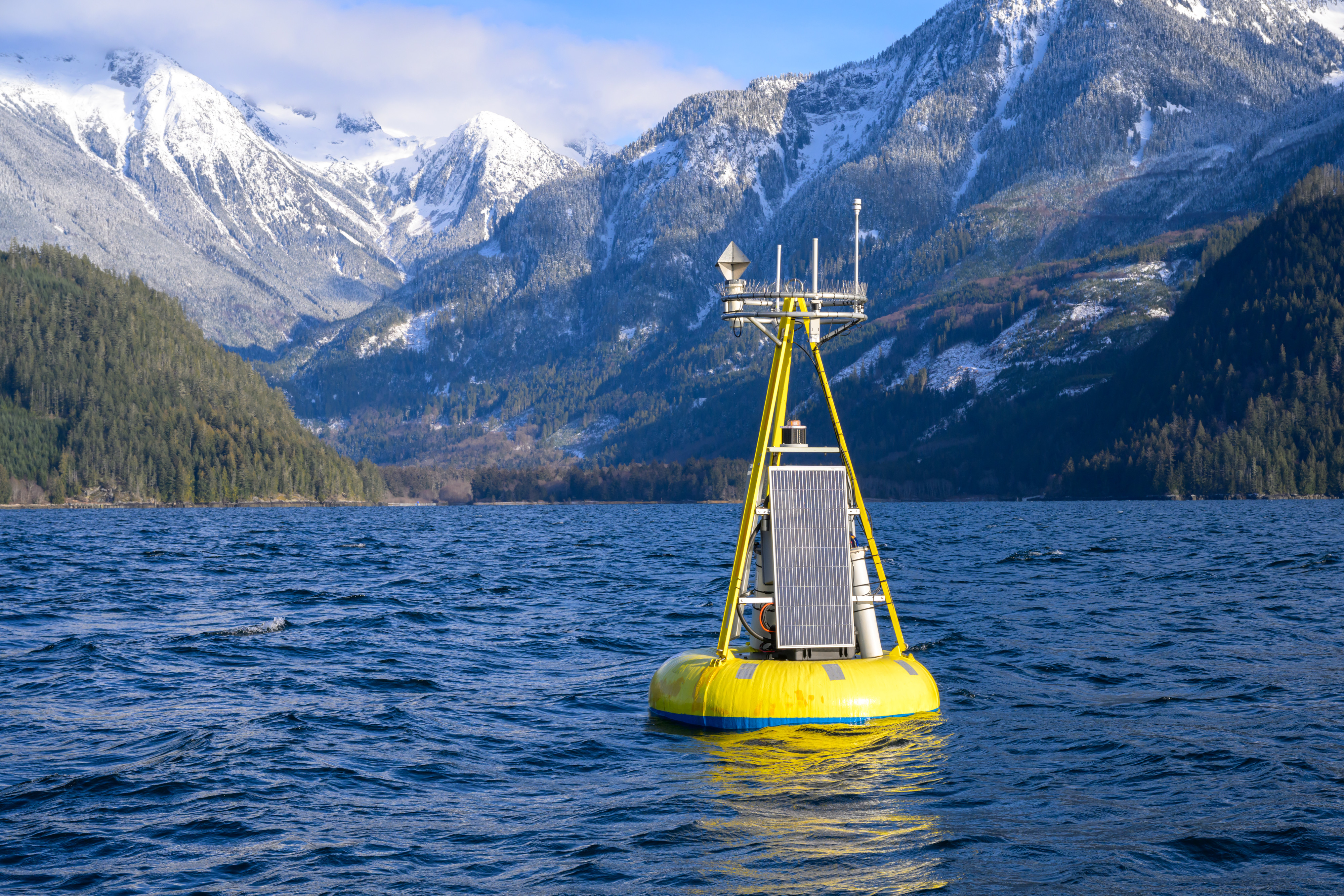
Ocean Gliders for Planning and Monitoring Remote Canadian Pacific Marine Protected Areas
Given the United Nations’ ambitious goal—endorsed by more than 100 nations, including Canada—of protecting 30% of the world’s marine ecosystems by 2030 (UN, 2023), the need to establish, expand, and track the effectiveness of protected areas is becoming more pressing each year. Effective planning for and monitoring of marine protected areas (MPAs) rely on the availability of quality baseline ecological and oceanographic information. Many of the sites in the Canadian Pacific Ocean best suited for protection, due to the confluence of ecological, cultural, and political significance, are remote. This poses two challenges: (1) there is little baseline information to guide planning, and (2) they are challenging to monitor once established.
Ross, T., Dosser, H., Klymak, J., Evans, W., Hare, A., Jackson, J., & Waterman, S. (2025). Ocean Gliders for Planning and Monitoring Remote Canadian Pacific Marine Protected Areas. Oceanography. https://doi.org/10.5670/oceanog.2025e104
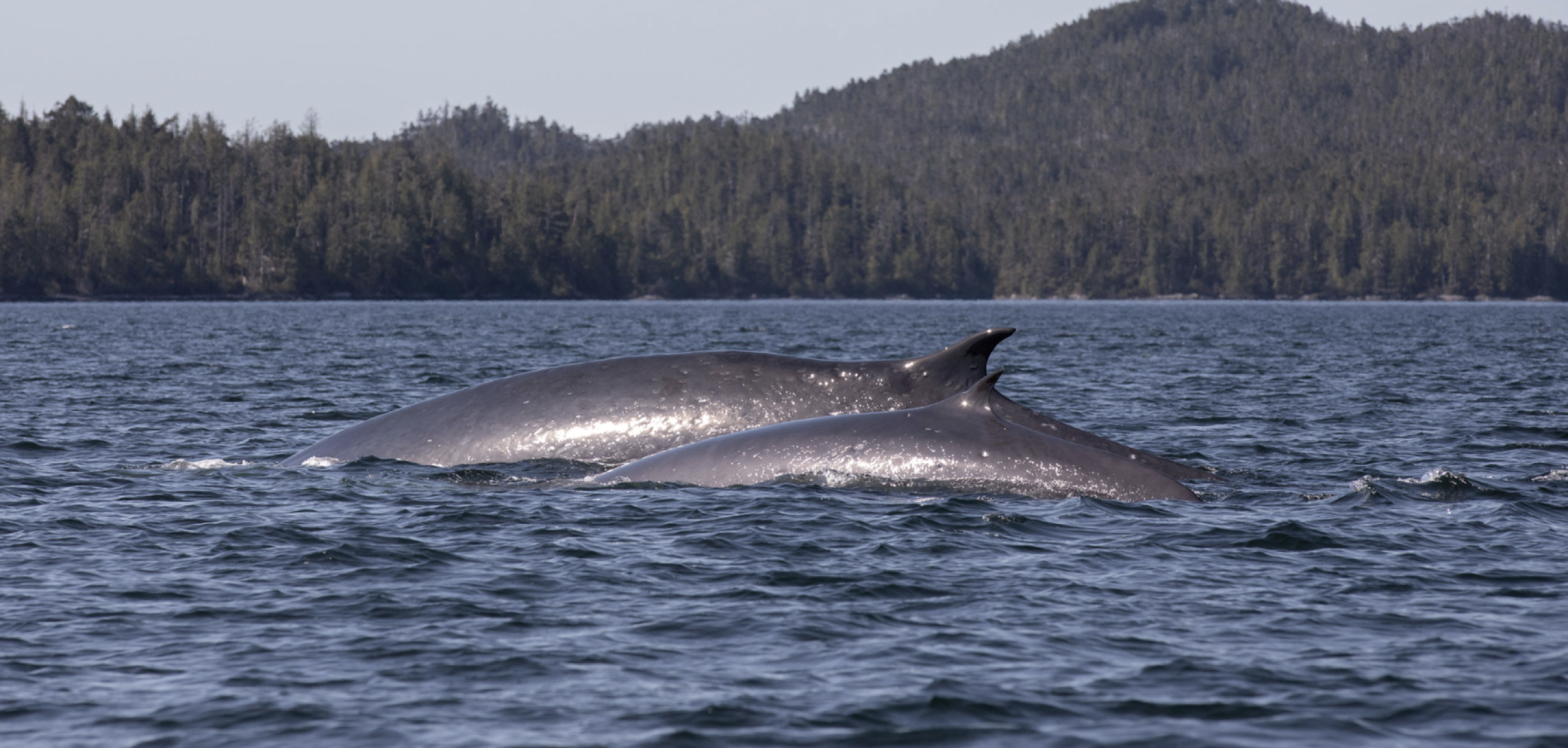
Bull kelp (Nereocystis luetkeana) growth rates as climate stress indicators for Canada’s Pacific coast
Primary producers’ growth rates are ideal bioindicators of changing climate due to their sensitivity to environmental conditions. On the Central Coast of British Columbia, we assessed growth rates of Nereocystis luetkeana, a canopy-forming annual kelp, by assessing baseline variability in growth rates and their response to environmental conditions of over 600 individuals and across three sites (2016–2019).
Pontier, O., Rhoades, O., Twist, B., Okamoto, D., & Hessing-Lewis, M. (2024). Bull kelp (Nereocystis luetkeana) growth rates as climate stress indicators for Canada’s Pacific coast. FACETS, 9:1-19. https://doi.org/10.1139/facets-2023-0237
Advancing an integrated understanding of land-ocean connections in shaping the marine ecosystems of coastal temperate rainforest ecoregions
Land and ocean ecosystems are strongly connected and mutually interactive. As climate changes and other anthropogenic stressors intensify, the complex pathways that link these systems will strengthen or weaken in ways that are currently beyond reliable prediction. In this review we offer a framework of land-ocean couplings and their role in shaping marine ecosystems in coastal temperate rainforest (CTR) ecoregions, where high freshwater and materials flux result in particularly strong land-ocean connections.
Hunt, B. P. V., Alin, S., Bidlack, A., Diefenderfer, H. L., Jackson, J. M., Kellogg, C. T. E., Kiffney, P., St. Pierre, K. A., Carmack, E., Floyd, W. C., Hood, E., Horner-Devine, A. R., Levings, C. & Vargas, C. A. (2024). Advancing an integrated understanding of land-ocean connections in shaping the marine ecosystems of coastal temperate rainforest ecoregions. Limnology and Oceanography, 69(12): 3061–3096. https://doi.org/10.1002/lno.12724
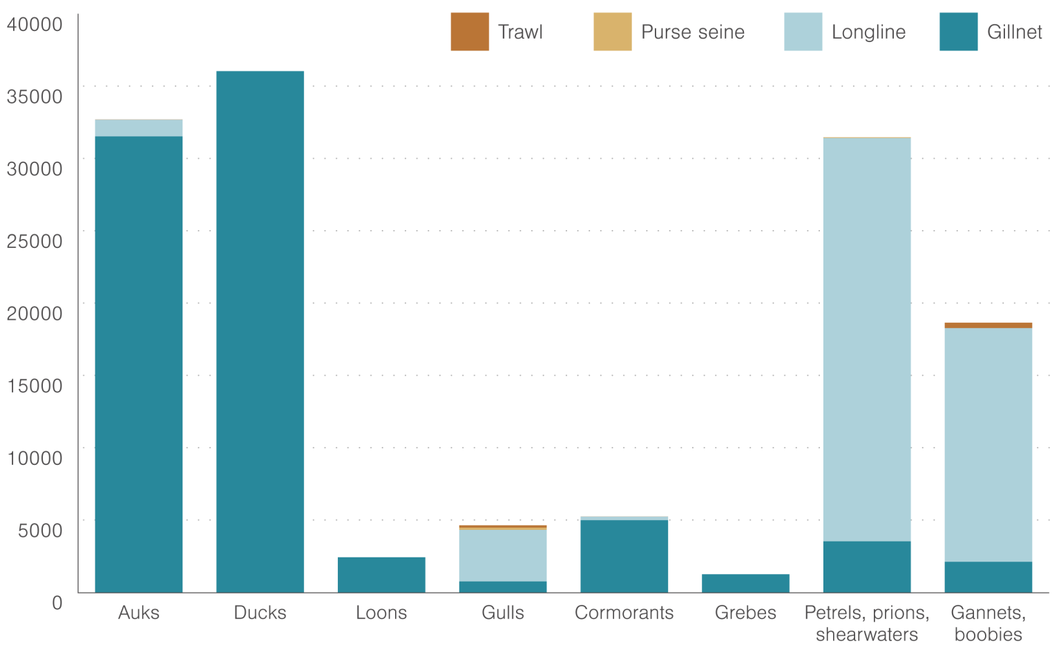
Marine and freshwater sounds impact invertebrate behavior and physiology: a meta-analysis
The diversity of biotic and abiotic sounds that fill underwater ecosystems has become polluted by anthropogenic noise in recent decades. Yet, there is still great uncertainty surrounding how different acoustic stimuli influence marine and freshwater (i.e., aquatic) communities. Despite capabilities to detect and produce sounds, aquatic invertebrates are among the most understudied taxa within the field of soundscape ecology. We conducted a meta-analysis to understand how sounds from various sources influence the behavior and physiology of aquatic invertebrates.
Davies, H. L., Cox, K. D., Murchy, K. A., Shafer, H. M., Looby, A. & Juanes, F. (2024). Marine and freshwater sounds impact invertebrate behavior and physiology: A meta-analysis. Global Change Biology, 30(11). https://doi.org/10.1111/gcb.17593
Seagrass wasting disease prevalence and lesion area increase with invertebrate grazing across the northeastern Pacific
Disease is a key driver of community and ecosystem structure, especially when it strikes foundation species. In the widespread marine foundation species eelgrass (Zostera marina), outbreaks of wasting disease have caused large-scale meadow collapse in the past, and the causative pathogen, Labyrinthula zosterae, is commonly found in meadows globally. Here, we investigated links between epifaunal grazers and seagrass wasting disease using a latitudinal field study across 32 eelgrass meadows distributed from southeastern Alaska to southern California.
Aoki, L. R., Ritter, C. J., Beatty, D. S., Domke, L. K., Eckert, G. L., Graham, O. J., Gomes, C. P., Gross, C., Hawthorne, T. L., Heery, E., Hessing-Lewis, M., Hovel, K., Koehler, K., Monteith, Z. L., Mueller R. S., Olson, A. M., Prentice, C., Rappazzo, B., Stachowicz, J. J., Tomas, F., Yang, B., Harvell, C.D., & Duffy, J. E. (2025). Seagrass wasting disease prevalence and lesion area increase with invertebrate grazing across the northeastern Pacific. Ecology, 106(1). https://doi.org/10.1002/ecy.4532
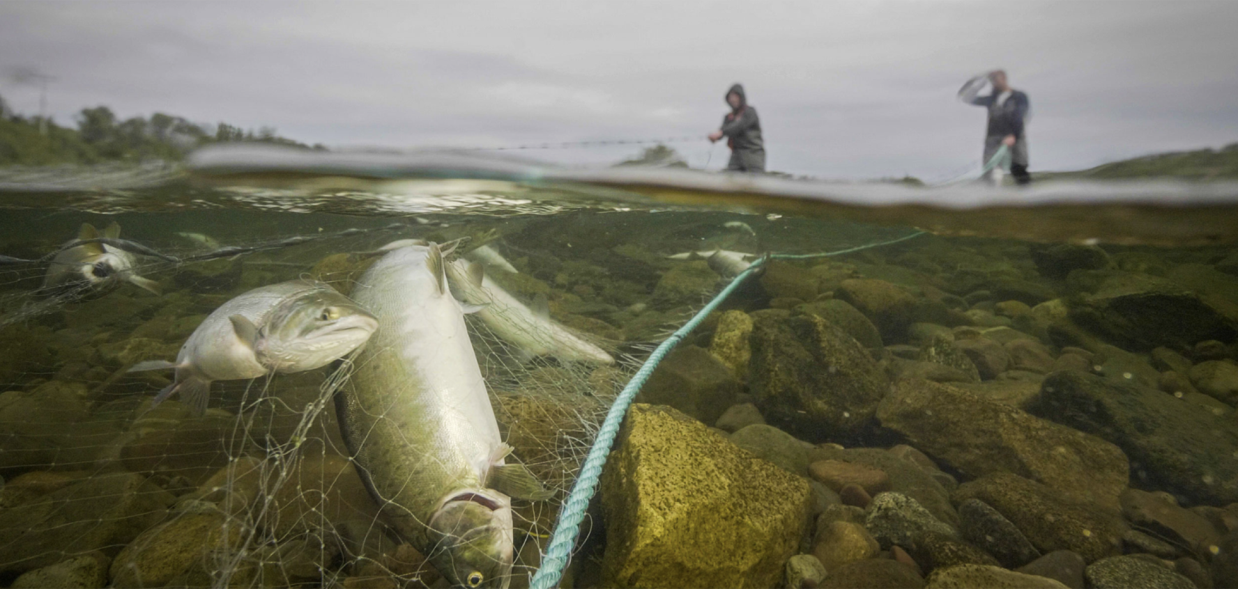
Developing a collaborative Dungeness crab larval monitoring network in the Salish Sea to provide long-term, fishery-relevant data
Many natural resources are managed without essential, biologically relevant data. Fisheries are particularly susceptible to this reality and, thus, are vulnerable to environmental changes and disturbances, with both human livelihoods and the health of ecological systems at stake. Here, we explore how the Pacific Northwest Crab Research Group (PCRG) employs a collaborative, stakeholder-driven approach to generate the information needed to inform a data-poor, co-managed fishery, using the example of Dungeness crab (Metacarcinus magister) in the northeastern Pacific’s Salish Sea.
Buckner, E. V., Grossman, S. K., Cook, C., Brownlee, A., Barber, J. S., Earle, H., Becker, B. J., Bosley, K., Harrington, N., McDonald, P. S., Paul, B., Homerding, M., Houle, K., Galiotto, A., Pantaleo, G., & Paul, A. (2025). Developing a collaborative Dungeness crab larval monitoring network in the Salish Sea to provide long-term, fishery-relevant data. Fisheries, 50(1), 5–18. https://doi.org/10.1093/fshmag/vuae002
Variability in storm season intensity modulates ocean acidification conditions in the northern Strait of Georgia
Large changes in marine CO₂ chemistry manifest in areas with weakly-buffered seawater where ocean acidification (OA) acts in concert with natural CO₂ additions. These settings can exhibit periods of extreme OA in the form of multiple co-occurring stressors, including calcite undersaturation and low pH. Such conditions were observed in the northern Strait of Georgia, on the northeast Pacific coast, where extreme OA spanned a 3-year period.
Evans, W., Campbell, K., Weekes, C., Del Bel Belluz, J., Barrette, J., Jordison, D., Mackenzie, C., Bergshoeff, J., Prentice, C., Savage, R., Desmarais, I., Feje, B., Myers, E., Bedard, K., Hare, A., Giesbrecht, I. J. W., Kellogg, C. T. E., Sandwith, Z., & Jackson, J. M. (2025). Variability in storm season intensity modulates ocean acidification conditions in the northern Strait of Georgia. Nature Scientific Reports, 15(1). https://doi.org/10.1038/s41598-025-88241-8
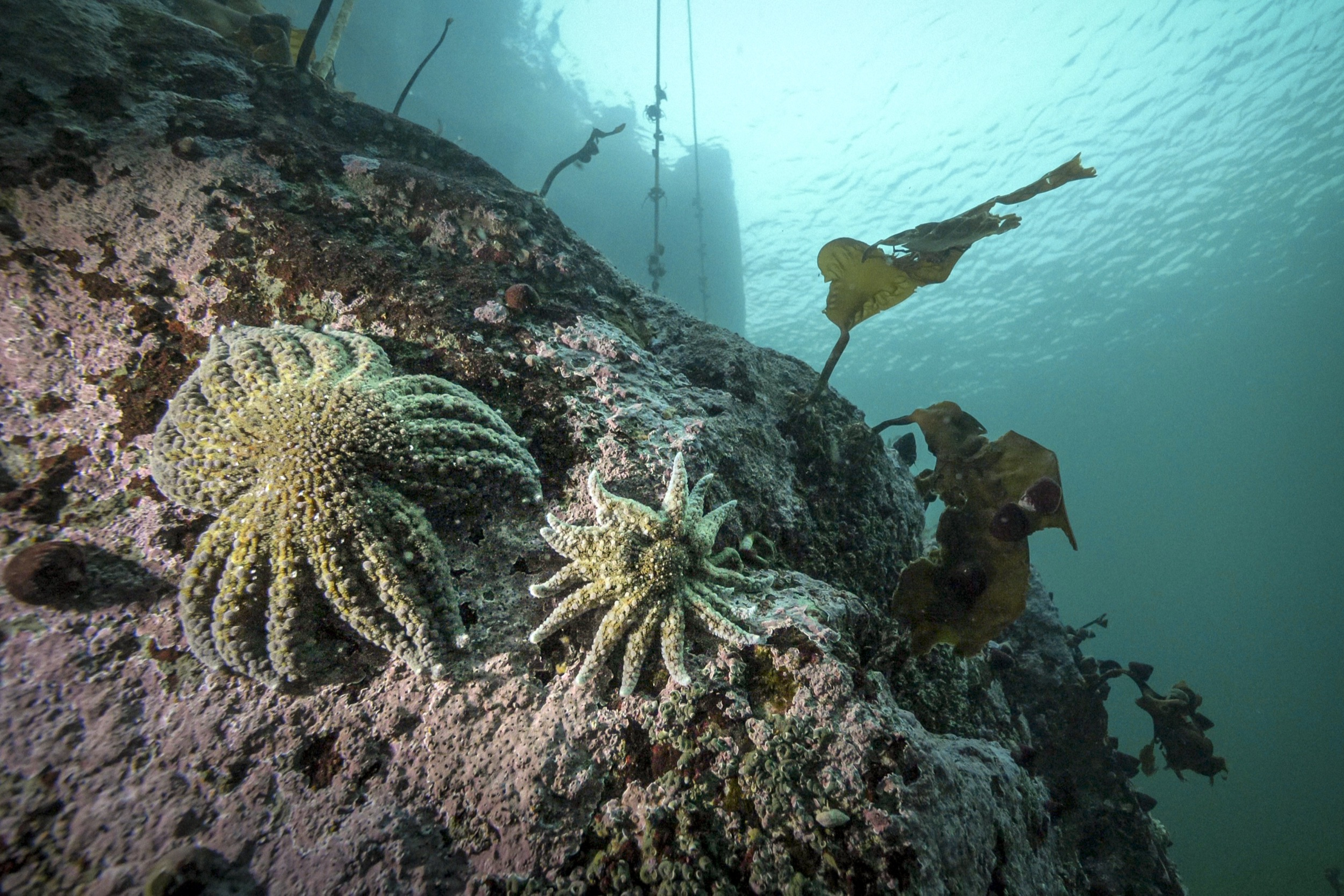
Fjord oceanographic dynamics provide refuge for critically endangered Pycnopodia helianthoides
Disease outbreaks as a driver of wildlife mass mortality events have increased in magnitude and frequency since the 1940s. Remnant populations, composed of individuals that survived mass mortality events, could provide insight into disease dynamics and species recovery. The sea star wasting disease (SSWD) epidemic led to the rapid >90% decline of the sunflower star Pycnopodia helianthoides. We surveyed the biomass density of P. helianthoides on the central British Columbia coast before, during, and after the arrival of SSWD by conducting expert diver surveys in shallow subtidal habitats from 2013 to 2023.
Gehman, A. M., Pontier, O., Froese, T., VanMaanen, D., Blaine, T., Sadlier-Brown, G., Olson, A. M., Montheith, Z. L., Bachen, K., Prentice, C., Hessing-Lewis, M., Jackson, J. M. (2025). Fjord oceanographic dynamics provide refuge for critically endangered Pycnopodia helianthoides. Proceedings of the Royal Society B, 292. http://doi.org/10.1098/rspb.2024.2770
Mapping the spatial heterogeneity of watershed ecosystems and water ecosystems and water quality in rainforest fjordlands
Small coastal watersheds (<10,000 km²) can play a large role in forming biogeochemical linkages between land and sea, yet the spatial heterogeneity of small watershed ecosystems is poorly understood due to sparse observations in many regions. In this study, we examined the spatial heterogeneity of water quality exported from diverse watersheds in two rainforest fjordland complexes.
Giesbrecht, I. J. W., Lertzman, K. P., Tank, S. E., Frazer, G. W., St. Pierre, K. A., Gonzalez Arriola, S., Desmarais, I., & Haughton, E. (2025). Mapping the spatial heterogeneity of watershed ecosystems and water quality in rainforest fjordlands. Ecosystems, 28. https://doi.org/10.1007/s10021-025-00964-x
Regression-based characterization of the marine carbonate system across shelf and nearshore waters of Queen Charlotte Sound
Marine carbonate system measurements are essential for understanding ocean acidification and CaCO₃ saturation states, and their response to oceanographic and anthropogenic processes. Acquiring such measurements in remote coastal areas is limited by challenges in the development and deployment of autonomous sensors for these parameters, and by the complexity and costs of directly measuring them. We address this challenge by extending an established method of estimating carbonate system parameters through proxy variables to the remote waters of Queen Charlotte Sound, British Columbia.
Hare, A. A., Evans, W., Dosser, H. V., Jackson, J. M., Alin, S. R., Hannah, C., Ross T., & Klymak, J.M. (2025) Regression-based characterization of the marine carbonate system across shelf and nearshore waters of Queen Charlotte Sound. Marine Chemistry, 270. https://doi.org/10.1016/j.marchem.2025.104511
Blue carbon stocks along the Pacific coast of North America are mainly driven by local rather than regional factors
Coastal blue carbon ecosystems such as seagrass meadows, marshes, mangroves, and other tidal wetlands, efficiently accumulate and store organic carbon in their sediments. For the west coast of North America, we investigated whether the amount of carbon stored in the sediment (“carbon stock”) differed by ecosystem type and whether differences were linked to local-scale factors such as elevation and plant type or to regional-scale factors such as latitude and climate conditions. We found the highest sediment carbon stocks in mangroves in Mexico and tidal swamps in the Pacific Northwest, ecosystems both dominated by woody plants.
Janousek, C. N., Krause, J. R., Drexler, J. Z., Buffington, K. J., Poppe, K. L., Peck, E., Fernanda Adame, M., Watson, E. B., Holmquist, J., Bridgham, S. D., Jones, S. F., Ward, M., Brown, C. A., Beers, L., Costa, M. T., Diefenderfer, H. L., Borde, A. B., Sheehan, L., Rybczyk, J., Prentice, C., Gray, A. B., Hinojosa-Corona, A., Ruiz-Fernánez, A. C., Sanchez-Cabeza, J., Kohfeld, K. E., Ezcurra, P., Ochoa-Gómez, J., Thorne, K. M., Pellatt, M. G., Ricart, A. M., Nahlik, A. M., Brophy, L. S., Ambrose, R. F., Lutz, M., Cornu, C., Crooks, S., Windham-Myers, L., Hessing-Lewis, M., Short., F. T., Chastain, S., Williams, T., Douglas, T., Fard, E., Brown, L., & Goman, M. (2025). Blue carbon stocks along the Pacific coast of North America are mainly driven by local rather than regional factors. Global Biogeochemical Cycles, 39(3). https://doi.org/10.1029/2024GB008239
DNA metabarcoding captures temporal and vertical dynamics of mesozooplankton communities
In this study, we evaluated how well DNA metabarcoding of environmental samples captures changes in marine mesozooplankton community composition to optimize the use of sequencing data for studying seasonal dynamics. Although DNA metabarcoding is increasingly used to monitor the distribution of marine communities, there is a lack of standardized methods, and it remains uncertain to what extent the DNA data reflects patterns of community dynamics observed by other methods.
Novotny, A., Rodrigues, C., Jacquemot, L., Clemente-Carvalho, R. B. G., Piercey, R. S., Morien, E., Galbraith, M., Kellogg, C. T. E., Lemay, M. A., & Hunt, B. P. V. (2025). DNA metabarcoding captures temporal and vertical dynamics of mesozooplankton communities. ICES Journal of Marine Science, 82(2). https://doi.org/10.1093/icesjms/fsaf007